Showing posts with label highways. Show all posts

Sunday, July 4, 2010

An unorthodox (and maybe crazy), but Really Simple idea for the CRC (and beyond)

It's time to take a little time off from the Independence Day (in the US) festivities to make a suggestion--that will likely be dismissed as crazy.  It's a proposal for the Columbia River Crossing that will strike many as absurd on its face--especially those who believe that a key goal of the project is to keep the freeway moving at "freeway speeds" for as many hours of the day as humanly possible.  It's an idea that some might not only consider foolish--but unpatriotic.  (The fact that certain ideas for bettering the country are considered treacherous in some quarters is itself idiotic in the extreme, but that's another topic...)

It's an idea that I can't take credit for... but I'll make the suggestion anyway.

A few weeks back, I had an email conversation with Jarrett Walker of humantransit.org fame on the Columbia River Crossing, a conversation which led to this post on the controversial project.  Most of the content of the email exchange went into the posting (after much editing and expansion), but one exchange was left out.  That exchange is the subject of this post.

Why is it so expensive, anyway?

One reason the project cost is so high is not the cost of the new bridge itself, but the cost to essentially rebuild I-5 and all its interchanges from SR500 on the Washington side, down to the Interstate Avenue interchange on the Oregon side.  That's a distance of almost five miles.  Why are ODOT and WSDOT so eager to pour $4 billion worth of concrete?

I-5, as currently designed, is functionally obsolete--there are numerous ramps with short distances between them, and ramps with very short merging lanes--particularly the two (from Hayden Island and SR14) immediately preceding the current bridge in both directions.  There's about seven onramps and offramps in each direction over the stretch, including an infamous 400 degree ramp (!!!) from OR99E northbound onto I-5 north.  (You cross over I5,  turn right, pass back under the freeway, and then do a 270 back onto I-5--at which point you have to merge quickly if you're not headed to Jantzen Beach).

Through the magic of such things as collector/distributor lanes and braided ramps--and a vastly widened bridge, the two state DOTs (or should that be DsOT?) intend to make I-5 once again compliant with Modern Design Standards.  Of course, it goes without saying that this sort of freeway construction requires a big footprint, a lot of concrete--meaning it does a lot of damage to surrounding urban fabric and costs a lot of money.

Whose design standards?

On my recent trip overseas, I noticed that many freeways in Hong Kong and China--both places are building them crazy, aren't built to anything remotely resembling US design standards--yet appear to be reasonably safe and functional.  A six lane footprint (3 per direction) was common, ramps were frequently closer than the 2 miles (3.2km) that DOTs and traffic engineers here prefer for ramp spacing on arterial freeways.  So I asked Jarrett, who's been in far more places than I have, about this:

Which gets me thinking:  Are US standards for freeway design to strict?  Is safety over-emphasized--a common issue with wealthy countries?  (It's interesting to compare China and India--for example, see this article).  Or is this an example of mobility values (in the highway sense of the term) trumping access?  For a highway which penetrates the downtown core of a major city, it seems to me that access concerns ought to predominate--which means more ramps and lower speeds, not designing the thing so that through traffic can blast through at 55MPH (90 km/h) during rush hour, but with a tremendous footprint that wholly disrupts neighboring communities.  Should highway engineers distinguish between "through" freeways" and "access" freeways--right now, pretty much all freeways are classified as throughput-focused arterials. 

And Jarrett responded:

Re road standards for merges, etc, I think you're on the right track.  Most standards for these things presume a "design speed," and you can reduce the amount of facility that the standards require by reducing the design speed.  For example, there is some speed (of the entire freeway) at which the southbound ramp from SR 14 would be workable.  What is it?  30 mi/hr?  It seems to me that one no-project solution -- as long as the thing isn't really in danger of collapse -- is just to lower the speed limit to whatever the road geometry can serve.  Throughout the CRC debate, any reference to highway design standards should be met with queries about design speed, and whether that speed is appropriate.
While I'm not one that favors a "no-project" solution--no project means no transitway (whether bus or rail), no decent pedestrian or bike facility, and continued interference with the Columbia navigation channel.  I'm in the "do something" camp, just not the "build a 12-lane behemoth" camp.


One foot on the brake, and one on the gas.... 


So here's a thought experiment:  What if I-5 were signed for a lower speed for a couple of miles; and the DOTs could just do a bridge replacement without having to rebuild the entire freeway as currently proposed?  (Or could build less?) What affects would that have?  Would the existing freeway, sans the current bridge, function adequately at the lower speed?

Some of the consequences would be:
  • Through trips on the freeway through the 35MPH section would take about 50% longer, assuming in either case, motorists routinely travelled 5MPH over the posted speed.
  • Highway throughput (per lane) might decrease slightly.  A good approximate value for the throughput of a highway is 1800 vehicles/lane-hour, which is easily derived when one considers the two-second rule.  If one vehicle passes by a point every two seconds, that's 3600/2, or 1800 per hour.  A slightly more accurate formula (accomodating for the fact that cars take up room) is 1800*x/(x+5), where x is the speed in MPH--if x is 60, that comes to 1661 vphpl, at x=40 we get 1600 vphpl.  More detailed analysis of this requires traffic engineering chops I don't possess (I'm not that kind of engineer).
  • Lower speeds may turn marginal ramps configurations into acceptable ones.  The length of ramps (and of merging lanes) is dictated by the need to provide room for vehicles to safely accelerate to (or decelerate from) freeway speed, and in the case of onramps, successfully merge with freeway traffic.  For loop ramps such as ramp from SR14 to I-5 south, and any ramp with with metering signals (essentially, all of them in the project area), the portions of the ramp which precede the signal and the straightaway don't count.
  • Lowering the speed limit wouldn't help the fuel economy of combustion-powered passenger cars much, and for some models may hurt slightly.  Two important factors for fuel economy of a combustion-powered vehicle are its aerodynamic properties, and its transmission.  Most passenger cars are sufficiently aerodynamic that drag doesn't dominate fuel economy until speeds exceed 60MPH (97km/h) or so--and given that, transmission gear ratios are chosen so that the car performs well in the highest gear at that speed.  A highway speed which prevents the use of high gear would negatively impact the fuel economy of combustion-powered vehicles.
  • On the other hand, diesel-electric and electric powered vehicles, as well as some types of hybrids, have different considerations  Internal combustion engines generate low torque at low RPMs (and stall outright if engine speed drops too low), and thus need mechanical transmissions or torque converters to keep the engine turning at adequate speed regardless of the vehicle's speed.  Electric motors can generate high torque at low RPMs (includng zero)--thus low-speed operation can occur at correspondingly low engine speeds, with the result that fuel economy doesn't suffer from the need to downshift or idle.
  • For large vehicles, regardless of the powertrain, drag will dominate fuel economy at far lower speeds.  Fuel economy for pickups and SUVs tends to peak at 40-45MPH (65-72 km/h); and larger vans, trucks, and busses peak at even slower speeds.  Any reduction in highway speeds will improve fuel economy for these vehicles.
  • Speaking of such vehicles, they often take a long time to accelerate to typical freeway speeds, causing potentially more disruption when merging in and out of traffic at higher posted speeds.
  • At lower speeds, the storage capacity of a highway increases (the number of vehicles which can be accommodated on a given chunk of concrete).  Storage capacity is maximized at low speeds, which is one reason traffic jams are so popular.


Where else?


Lowering the speed limit might help with some other stretches of substandard highway in the Portland area as well.  OR 217, linking US26 in Beaverton to I-5 in the Tigard/Lake Oswego area, is a notorious parking lot, owing to having about 10 interchanges along its 7-mile (11km) length. In Beaverton, there's a stretch of four consecutive interchanges (Denney, Allen, OR 8/10, and Walker) where one ramp's onramp and the following offramp are each about 1000' (300m) apart.   Last year, ODOT considered closing numerous ramps along the freeway during rush hour, to improve the highway's performance--an idea which was unsurprisingly unpopular with Beaverton and Tigard residents.

The problem with ODOT's proposal is that it focuses too much on mobility, and not enough on local access. While 217 serves an important role connecting the high tech Beaverton/Wilsonville corridor with I-5, it also serves much local traffic as well.  The area doesn't have anything resembling a fully-connected street grid, and the parallel local transit service (WES, and the 76 bus which is well-used, but infrequent and slow) leaves much to be desired. 

Plans to widen the freeway are in the works; although it is rather early in the process--and simply widening the highway will not fix the problems, as the study report indicates.  The report in question also calls for "interchange improvements"--braided ramps and such--if and when funding becomes available.

If instead of doing this--could simply slowing down the highway, to make the existing ramp configurations safe(r)--improve traffic outcomes at a fraction of the cost?  End-to-end commute times between I-5 would increase by several minutes in the worst case; but in times of congestion, the effective speed limit on the highway drops dramatically due to the numerous merge/weave conflicts--and that's without an accident occurring.


Precedents?
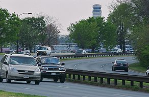

It is widely assumed, in the United States, that 55MPH (90km/h) or faster is the default minimum speed for freeways, without good reason otherwise.  Mitigating dangerous road conditions due to geography is often considered acceptable; Interstate 5 is signed at 50MPH (80km/h) through the Terwilliger Curves (a notorious set of S-curves on a fairly steep grade, where the freeway passes through the Tualatin Mountains just south of downtown).  However, the idea of mitigating dangerous road conditions due to excessive access seems to be out of scope--many take it as an article of faith that the proper response in these conditions is to redesign or eliminate the access in question--even if it costs billions of dollars and greatly increases the highway's cross-section.

But there are plenty of examples of freeways with lower speed limits, many of them labeled as "parkways".  In Washington DC, for instance, one finds the George Washington Memorial Parkway and the Clara Barton Parkway--both controlled access, divided highways which look and act like freeways; yet are signed with speed limits ranging from 25-50 MPH (40-80 km/h).  Even the Baltimore/Washington Parkway, a major freeway between DC and Baltimore, is signed at 45MPH for quite a bit of its length.  Yet all three roads are widely used (and widely accepted) by Washington-area commuters.


Bottom line


The bottom line for this post is the following:  Freeways perform fine at lower speeds.  The most important attribute of a freeway is not a high speed limit, but controlled access and grade separation--the free flow of traffic.  These attributes make safe travel at high speed possible--highways in urban areas which have high limits but at-grade intersections or unlimited property access tend to acquire reputations as deathtraps--or as ODOT likes to call them, "safety corridors".   However, high speeds are not necessary for a freeway to function as a freeway--and eliminating things like stoplights and driveways will go a lot longer to improving the speed of a highway than simply raising the limit.

And in the urban context, where the regional mobility function of a highway frequently comes into conflict with the access functions, attempts to simultaneously improve mobility while keeping speeds high, generally are expensive--and interfere greatly with the surrounding community.

Trading speed (or other performance measures) of for reliability is a common solution in many engineering domains, not just traffic engineering. Yet the tradeoff seems to be something which is regarded as unthinkable by many.

Which is unfortunate. We could vastly slow down our need to engage in expensive and destructive highway re-designs... if we could simply slow down.

[edited for typos]

Tuesday, June 22, 2010

The Columbia River Crossing, and the role of state DOTs


[Image courtesy of CRC]

This blog, so far, has avoided serious comment about one of the most controversial projects being considered for the Portland metro area--the Columbia River Crossing.  Recently, I wrote about a blog comment concerning the advisability of adding MAX service to the project, in order to make a point in the bus/rail debate, but I haven't blogged about the CRC itself.  Now, it's time to correct that oversight.

The CRC project organization, which is jointly run by the Oregon and Washington Departments of Transportation (ODOT and WSDOT), recently published a proposed design for a replacement of the Interstate Bridge (an ancient pair of drawbridges which carry Interstate 5 over the Columbia River).  The price tag for the proposed design:  over US$4 billion.  Hardly anybody on either side of the river likes the proposed design, especially in the two cities (Portland, OR, and Vancouver, WA) which are directly affected by the project. 

The proposed design

The proposed design includes the following features:
  • Rebuilding I-5 to modern design standards for about 5 miles--essentially from the Interstate Ave. interchange in Oregon, up to SR500 in Washington; this requires construction of quite a few C/D lanes and braided ramps and such.
  • Three "through" auto lanes, and three "auxiliary" lanes, in each direction across the main span.  The auxiliary lanes are lanes which sooner or later you'll have to exit if you use them (though the freeway is always 8 lanes wide through the project area, except at the ends), while the "through" lanes are continuous.  On the main span of the bridge, all six lanes in each direction are on a single carriageway; there is no segregation into highway and C/D lanes.  (A recent revision to the proposal includes only 2 auxiliary lanes per direction rather than three, but keeps some of the other controversial features of the project)
  • Below the highway lanes will be a facility for pedestrians and bicycles, and two "transit lanes", which will contain light rail.  (AFAIK, it will be trains only; not a combined rail/bus facility like the Caruthers bridge which is part of the Milwaukie MAX project).
  • The impacts on Hayden Island, an island in the Columbia (part of Oregon, as it is south of the main channel) will be particularly server.  The I-5 interchange on the Island will be kept, but significantly redesigned.   Rather than the treacherous "trumpet" interchange (with short ramps) that currently sits there, a braided ramp confiuration will be added, which will also include ramp structures crossing the Columbia Slough for accessing Marine Drive and OR99E.  The effective footprint on Hayden Island will be 22 lanes.  As is the case today, road access to Hayden Island will require use of I-5. (The picture at the top of this post is an illustration of what this might look like--it appears that a giant aircraft carrier was parked in the middle of the island).
What's wrong?

Most people in the community recognize the need to do something.  The Interstate Bridge is functionally obsolete.  It's a major bottleneck for traffic, especially during the afternoon commute.  The connecting ramps are dangerous, particularly the onramps from Hayden Island onto I-5 north, and from SR14 onto I-5 south.  The pedestrian facilities on the existing are downright scary; there's no dedicated transit infrastructure at all, and the bridge must occasionally lift for river traffic.   And the combination of the drawspans of the Interstate Bridge, and the BNSF rail bridge a short distance downstream, make river navigation difficult for large vessels.  There's also some structural concerns:  although the bridges are not yet structurally obsolete, extensive work would be needed to bring them to modern structural standards.  There's a large consensus that the status quo is not acceptable.

But there's little agreement among local stakeholders (even ignoring the DOTs for now) on what needs to be done.  There is rampant sticker shock at the $4 billion pricetag on both sides of the river; and calls to scale back the design--but the sticking point is just what ought to be removed.

We don't need no stinking freeway

Many in Portland's transit and urbanist communities view the Interstate Bridge as an important chokepoint with which to discourage automobile use, and don't want to see any highway capacity added, other than what's absolutely necessary for safety.  Portland's urbanistas, while disliking suburbia in general, hold special disdain for the community across the river which is often derisively called "Vantucky" (and worse), and viewed as a gaping loophole in Oregon's land use laws (and Metro's implementation thereof).  Expanding freeway capacity into The Couv (what Vancouverites often call their city--a term which has the added benefit of only referring to Vancouver, WA and not Vancouver, BC; a persistently annoying ambiguity in the Pacific Northwest) would only encourage more urban sprawl across the river, they say, and the sort of capital flight that has devastated many cities elsewhere in the country.  (More than a few would be happy if the Interstate Bridge were to fall down into the river).

Another concern that Oregonians have, and one less politically sensitive, is the concern that widening the bridge will simply move the southbound bottleneck on I-5 a few miles further south, into downtown Portland--necessitating a costly rebuild of Portland's downtown core.  (In the Rose Quarter area, I-5 reduces to only two lanes in each direction).   And the eastbank freeway, as I-5 is known in downtown, is highly unpopular, and a favorite target of urbanists who would prefer to see it buried (or removed altogether).

We don't need no stinking tolls

Across the river, many in Vancouver naturally resent being viewed as Portland's Oakland.  Vancouverites, like many suburban-dwellers, don't consider their chosen lifestyle to be illegitimate in the least.  Many consider the problems of cities to be the problems of cities--not their concern.  And many in Vancouver are openly skeptical about Portland's famously liberal political consensus (and recently, famously dysfunctional city politics).   They aren't terribly interested in Portland's transit system or enviro-urbanist agenda--and are primarily concerned about the cost of the project.  This is especially important on the Washington side since tolls are a significant part of the proposed funding package.  Vancouver residents enjoy an advantageous tax situation, in that Washington has no state income tax (and very low property taxes), financing government primarily through sales taxes; whereas Oregon has no sales tax.  Thus many Vancouverites cross the river to shop in Oregon.  (Many also work in the Beaver State; though those who do are subject to Oregon state income tax).  Tolling is seen as an unfair surcharge on those who live on the north side of the river; and thus many Vancouverites see reducing the scope of the project--and thus the cost--as a key priority.  (The recent mayoral election in Vancouver turned on the question of bridge tolls; with the incumbent mayor losing re-election to a candidate who focuses on the issue of tolling).

The prospect of tolls also brings about concerns that traffic would be simply shifted to the Glenn Jackson bridge instead; particularly N/S through traffic, and traffic from the E. Vancouver area.    Tolling I-205 was proposed as a solution to this issue (the Glenn Jackson bridge, about seven miles upstream, is not part of the project); however it seems to be the opinion that this is not legally permissible.   This state of affairs in Clackamas County, to Portland's south, worried.

The result of this is that many in Portland want to see the highway features of the design reduced in scope.  A popular alternate proposal is for a seismic retrofit of the existing bridges, removal of many of the interchanges (including the dangerous Hayden Island ramps), and construction of a "supplemental bridge" which would connect Vancouver's downtown street network with Hayden Island and Portland streets such as MLK and Interstate, and provide transit, pedestrian, and bicycle facilities.  Many in Vancouver, OTOH, want the highway capacity, and would just as soon jettison the light rail lines--noting that the tracks would only go a short distance into Vancouver.

The devil's in the DOTails

If the issue were merely a disagreement between two cities (located in two different states) on urban vision, that would be one thing.  But the two state DOTs, who are responsible for maintaining I-5 and have been managing the project, seem determined to build a big megafreeway.  A common allegation is that the acceptance criteria set forth in the purpose and need statement were carefully crafted to exclude any solution other than a big megafreeway, and as a result--a big megafreeway is what the engineers came up with.   And now, the DOTs are (allegedly) playing "chicken" with the project--claiming that it's too late to make any material changes, lest the funding window for federal dollars close (the project is slated to receive funding from USDOT's Corridors of the Future program).  The city of Portland, in particular, is calling that bluff; and actually hired its own engineering firm to review the project.  Metro has been challenging the state DOTs in unusually blunt language as well, with outgoing Metro president David Bragdon suggesting that the CRC project team "get real". 

The project's design is severely constrained by several other factors:  the need to maintain a Columbia River shipping channel compatible with the BNSF rail bridge a short distance downstream, and the need to not affect the flight paths going in and out of Pearson Airpark in Vancouver (and to a lesser extent, PDX).   Until recently, Portland mayor Sam Adams also stressed the need for a "signature design" (a demand that the bridge be architecturally significant), a position that struck many as self-aggrandizement and placement of form over function--especially given the height restrictions which prevent the construction of towering arches or suspension systems.  (The proposed design, with box/girder construction, has also been criticized for being ugly).  As Adams has been politically weakened by a sex scandal, this concern has faded to the background, but still lingers.


A major issue with having state DOTs maintaining urban infrastructure, is that many of them are institutionally programmed to the "mobility" side of the mobility-access continuum.  Despite the multi-modal nature suggested by the name "department of transportation"; the primary responsibility for DOTs in most US states is building, maintaining, and regulating highways, often focused on smooth and timely passage of freight.  Other modes of regional or long-haul transportation--aviation, railroads, and navigation (whether on inland waterways or at sea) have long been primarily overseen by the Federal government, as are interstate motor carriers.  Local transportation links (including transit), on the other hand are generally handled by local communities.  Building highways is what DOTs are best at; and this role emphasizes throughput and mobility over local concerns such as access and community integration.  A big problem with freeways, generally, is that many of them don't really serve the communities they pass through; instead they simply disrupt them. 


It should be noted that this state of affairs exists despite having relatively transit-friendly administrations in Salem and Olympia.  Democrats occupy the governor's office in both Oregon and Washington, and control the legislatures of both states as well.  While both states have bicameral legislatures (the norm in the United States); both the upper and lower legislative houses in the two states are allocated based on population, not political subdivision.  (Many state Senates, as well as the US Senate;The US Senate assigns equal representation to political subdivisions regardless of population; a state of affairs which allows rural interests to dominate; for example, Alaska and New York each have the same number of US Senators--two). 


The good news

This project is a classic case of the paralysis that can result when state-level entities such as DOTs manage urban infrastructure projects.  The CRC is a particularly complex case, involving DOTs, MPOs, transit authorities, counties, and cities from two states and not just one.  Given that the project crosses a navigable waterway, is in close proximity to two airports, and even lies adjacent to a national park facility (Fort Vancouver); there are numerous Federal agencies involved as well, including several beyond the usual suspects.  There are many different players, all with different goals for the project, all playing hardball, and no supervising organization with the capability (or the authority) to solve the political conflicts necessary to generate reasonable requirements that are acceptable.   (Kind of reminds me of healthcare reform, actually).  Right now, many of the parties are perfectly happy to not cooperate, and to threaten to block any proposal which doesn't meet their specific needs.  (An ODOT official was actually quoted stating that Portland wouldn't be permitted to expand light rail across the Columbia unless as part of a larger highway project; and of course many in Portland hold the same attitude in reverse towards freeway expansion).

Whether this circle can be successfully squared remains to be seen.  The good news is that the DOTs are starting to get the message, so there's hope that a reasonable design can be produced.  OTOH, even if the DOTs let the two cities and their respective MPOs take the lead, there's bound to be friction given the apparent clash in values.

[Edited for correction as noted in comments]