Showing posts with label access vs mobility. Show all posts

Sunday, July 18, 2010

Impedance matching and transit

This morning, the DHT takes a minor break from discussion of the Lake Oswego transit project, to emphasize a fundamental principle of transit design (one that certainly has relevance to Lake Oswego, and beyond).  Yours truly hold an MS in Electrical and Computer Engineering from Oregon State University, which implies that I know something about electricity and electronics.  (That said, I've spent the past fifteen since graduation doing software, which implies that I've probably forgotten most of it).  However, one important principle of electrical engineering, that of impedance matching, has significant relevance by analogy to transit.

Impedance is defined by Wikipedia as a quantity which "describes a measure of opposition to alternating current (AC)."  While I have some quibbles with that particular phrasing, they're off topic here on the DHT--the definition given is good enough for the purposes of this post.  Impedance can be broken down into two fundamental components: resistance (opposition to non-changing, or direct, current--always a positive number), and reactance (opposition to changes in current, which can be positive, negative, or zero).  Electrical circuits can be modified by a source (typically a voltage source, such as a battery or power supply), and a load (the device that does whatever work or performs whatever function is desired).  Both the source and the load have an impedance associated with them, and the behavior of the circuit depends on the impedance of both components.

Why impedance matters

In many applications, it is important that the impedance of the source and load be matched--a condition which occurs when the resistance of source and load are the same, and the reactance of source and load sums to zero.  Impedance matching is required for maximum transfer of power from source to load, and for minimizing "reflections" of the signal (which can disrupt communications).   The latter phenomenon is too complicated to do justice to in a post for laypersons; but the former can be be explained easily enough:  The power consumed in a circuit element is the product of the voltage drop across it, and the current which flows through it:  P = VI (I is used for current in the field of electronics--C is used for capacitance).   The current through a circuit element can be computed by dividing voltage over impedance: I = V/Z (Z = impedance; don't ask me why).   The total voltage of the source is distributed across the source and load impedances, V = VS + VL; where VS = VZS/(ZS + ZL) and VL = VZL/(ZS + ZL).  Thus, doing a bit of math produces the result that the power dissipated by the load is ZL (V/(ZS+ZL))²  Given that the source impedance ZS is often fixed, a bit of calculus shows that the load power is maximized when the load impedance ZL is set to match it. 


One problem with impedance matching is that while load power is maximized; so is source power, such circuits are only 50% efficient.  Efficiency can be computed by dividing load power over total power, under the assumption that only load power is used for doing useful work. To maximize efficiency, one deigns so that the load impedance as high as possible.  This limits the amount of power which can be delivered to the load, but in many cases that doesn't matter--if you have a 60W light bulb, it doesn't matter that the household circuit may be capable of delivering 2kW--you only need 60W to make the thing work.  Maximum efficiency is achieved by making the load impedance as high as possible relative to the source impedance.   This technique, impedance bridging, is generally only used in situations where reflections aren't an issue. 


On the other hand, if the load impedance is lower than the source impedance, to much power is wasted in the source or the interconnecting wires.  This is generally not a useful case, and in extreme cases is known as a "short circuit".

What of the source impedance itself? The source impedance of a power supply is in many ways, a figure of merit--lower is better.  A power supply with a lower source impedance will be able to deliver a higher maximum power for a given voltage level than a supply with a higher impedance; and will waste less power no matter what the load.  Unsurprisingly, designing power supplies with very low impedances is difficult and expensive. 

(EEs may note that I'm glossing over power supplies modeled as current sources--and they would be correct.  I'm glossing over lots of things...) 

What does all of this have to do with transit?

Good question. 

When designing a transit line, there are several important factors to consider:
  • The nature of the route (including the vehicles): 
  • The nature of the stops (distance between, amenities, platform height, etc)
A transit vehicle or system does two important things:  It stops to pick up or drop off passengers, and it moves to the next stop.   For both functions, minimization of time is required.  It's relative easy to come up with first-order figures of merit for both operations:


First, consider a transit vehicle which is deadheading on its route.  Here, the vehicle traverses the route, running under normal conditions and at normal speed--stopping at traffic lights, stop signs, and for obstacles in the road (other traffic, pedestrians, debris) as necessary--but does not stop to pick up passengers.   We could measure its velocity over the route, under various conditions, to come up with a number we'll call the deadheading velocity, VD.  Higher is better, obviously--and various things can contribute to a higher deadheading velocity:  higher-performance vehicles, a dedicated guideway (no interacting with other traffic), priority at intersections, etc.


Now consider the hypothetical case of a vehicle which traverses its route, stopping at stations and stops in the ordinary manner--but travelling instantaneously from one stop to the next:  when the doors close at one stop, the vehicle and its passengers are teleported instantly to the next needed stop.  We add in a per-stop penalty for to account for acceleration and decelation as well. Assume that each stop is serviced normally--if little old ladies need to fumble through their purse to find exact change, that time is counted.  Were we to sum up all the stop times (averaged over numerous runs), and divide them into the length of the route, we would come up with a number I'll call the service velocity, VS


Now, let's invert the two parameters, VD and VS.  Science doesn't presently have a good term for the inverse of velocity, so I'll coin one:  lethargy, or L (LS, LD).  The lethargy of something is the amount of time it takes to cover a distance, divided by the distance.  Why do we use lethargy?  Because, lethargy is additive.  The total lethargy is simply the service lethargy plus the deadheading lethargy.  (One can invert the total lethargy to get the total velocity, or an approximation thereof--keep in mind, this is a crude model).  If it isn't obvious already; lower is better.


How lethargic is good?


What values of lethargy are good?  Bad?  Typical?  First, lets consider some typical LD values for various modes of transportation:
  • Jet air travel:  < 0.12 (>500MPH)
  • Turbofan air travel, true high speed rail: 0.2 - 0.3 (200-300 MPH)
  • Second-tier high-speed rail : 0.3 - 0.5 (120-200 MPH)
  • Amtrak, rural freeway: 0.7 - 0.9 (65-85 MPH)
  • Urban freeway (no congestion), grade-separated metro: 0.8 - 1.2 (50-75 MPH)
  • Rural highway: 1.1 - 1.3 (45 - 55 MPH)
  • Urban expressway with stoplights, i.e OR224: 1.5-1.7 (35-40 MPH)
  • Median-running light rail:  1.7 - 2.1 (28-33 MPH)
  • Urban boulevard: 1.8 - 2.2 (27-32 MPH)
  • Urban arterial: 2.4 - 3.0 (20-25 MPH)
  • Light rail, traffic in downtown grid: 2.4 - 3.0 (20-25MPH)
  • Residential streets: >3.0 (<20MPH)
Now, LS.
  • Point-to-point auto travel: < 0.1 
  • Point-to-point commuter bus/rail, >10 mile trip:  < 0.5 (assuming 2.5 mins for loading and unloading)
  • Point-to-point air travel: <300 mile trip (40 mins to load, 20 mins to unload plane): >0.2
  • Point-to-point air travel: <300-600 mile trip: 0.1 - 0.2
  • Point-to-point air travel, >600 miles: < 0.1
  • Corridor commuter rail/express bus (such as WES):  0.1 - 0.3
  • True-metro rapid transit, 1-2 mile stop spacing, 30-40 second dwell:  0.33 - 0.5
  • Transit, 0.6-1 mile spacing, 30 second dwell: 0.5 - 0.8
  • Transit, 0.4 - 0.6 mile spacing, 20 second dwell: 0.8 - 1.3
  • Transit, 0.2 - 0.4 mile spacing (1000-2000 feet), 15 second dwell: 0.6 - 1.2
  • Transit, 750 - 1000 feet, 15 second dwell (i.e. Streetcar):    1.2 - 1.6
  • Transit: 500-750 feet, 10 second dwell: 1.1 - 1.5
For a given service type, by adding the corresponding lethargies for the route type and the stop spacing, you get a good estimate of the overall lethargy--and the overall speed.


What lethargies do riders generally expect or encounter?  Values less than 1.5 are generally rare, but here are some "typical" values:
  • Point-to-point commuter rail: 1.5
  • Corridor commuter rail, i.e. Sounder or WES:  1.8-2.2 (WES is 2.4; due to shorter-than-typical stop spacing and tracks not rated for higher-speed operation).
  • Point-to-point highway-running express bus: 1.8-2.0 (i.e. C-Tran 199)
  • Corridor express bus: 2.2 - 2.6 (C-Tran 105)
  • "True" metro: 1.7 - 2.2
  • Dedicated-guideway light rail:  2.0 - 2.8:
  • Dedicated guideway BRT, limited stop, no signal priority:  2.5 - 3.0 (LA Orange Line)
  • Median-running light rail (i.e. yellow line): 2.8 - 3.2
  • Suburban highway bus: 3.0 - 3.5 (the 33 and 35 are both in this range)
  • Rapid streetcar:  2.8 - 3.5
    • Proposed Lake Oswego streetcar, LO-PSU:  ~3.5 
  • Downtown light rail: 3.5 - 4.0
  • Urban boulevard local bus (ie TriMet 9): 3.5-4.0
  • Local bus: 5.0 - 10.0
  • Portland Streetcar downtown:  ~8.0
Excluding express and commuter services, a common cutoff for rapid transit is a lethargy of about 3.0 (an average speed of 20MPH).  High-quality rapid transit can do 2.0 or better; medium-quality, about 2.5.   Frequent stop (non-express) bus service running in mixed traffic on ordinary streets has a hard-time doing better than 3.0, and mixed-traffic streetcar is unsurprisingly, very slow.


What does this all mean?

The reason I use lethargy, in addition to the fact that it's easy to compute with--is that it's analogous to the electrical property of impedance discussed in the first section.  Furthermore, deadheading lethargy is analogous to source impedance, and service lethargy is analogous to load impedance, in the following ways:
  • Power consumed in the load, and time spent picking up and dropping off passengers, is useful.  Whether a high or a low value is good or bad depends on the application--commuter rail (and point-to-point transport) have very low service lethargies, as the bulk of the time is spent in transit--but don't serve very many people.  Local bus service, on the other hand, has a very high service lethargy--it stops in lots of places--but this limits its effective speed.
  • Deadheading lethargy, like source impedance, is a figure of merit--the lower, the better.  And like source impedance, making it lower costs money.  Time spent in transit is generally time wasted, just as power consumed in the source is wasted energy.  
  • Most importantly, it is useful to match lethargies, just as it is useful in electonics to match impedance.  Building expensive transit infrastructure, but running services with frequent stop spacing on top of it, does not lead to better service, at least as far as this analysis is concerned.  (There may be other reasons--reliability, capacity, sex appeal, whatever, to do so; all of these things are outside the scope of this post).  
  • On the other side of the coin, running limited stop service in mixed traffic is useful--express bus and commuter rail being two examples--but these services generally have low impact.
  • Finally, like impedance, lethargy is logarithmic in its impact.  There's a  bigger difference between lethargies of 2 and 3, then between lethargies of 5 and 7, for instance.  This logarithmic nature makes higher-performance lines difficult and expensive to build; it's far too easy to build too many stops on a line to garner greater political support, sabotaging its technical merit in the process.  (MAX downtown suffers from this problem to some extent--that said, MAX was designed to provide local service through downtown; not to be an efficient means for crosstown trips).

    Saturday, July 10, 2010

    Rapid streetcar, Portland, and the rail divide

    There's an article on the light-rail advocacy site lightrailnow.org, which introduces a concept known as Rapid Streetcar.  Rapid Streetcar, as they define it, is a rail transit system which is a hybrid between "traditional" mixed traffic streetcars, and light rail systems.  With a rapid streetcar design, streetcar-class rail vehicles (which weigh considerably less than light rail vehicles) are operated in exclusive rights-of-way in urban areas, often in lanes which were previously dedicated to automobile service, and often in multi-car trains.  The page goes into detail on the advantages (lower construction cost, ability to run in mixed traffic if necessary, the possibility of tram-train like operation) and limitations (speed and capacity) of such systems, and discusses Portland's rail systems in great detail.

    Of course, there's one catch:  Portland doesn't HAVE any Rapid Streetcar.  The article primarily uses Portland's streetcar system as an example of how such a system might be designed (focusing on details such as construction costs and techniques, station design, etc), while glossing over the fact that Portland Streetcar is, at present, a mainly mixed-traffic circulator system, not something marketed as rapid transit (or rapid anything).  Portland does have rail lines with service parameters that satisfy the conditions for Rapid Streetcar--but those lines (such as the Yellow Line) are running light-rail rolling stock, not streetcars.  There has been some discussion of Rapid Streetcar in Portland, but currently none exists.

    As the article notes, "Rapid Streetcar" is not really a novel idea; many European tram systems have been operating in this fashion for decades.  It is more novel in the American context--the legacy streetcar systems which operated in the early 20th century before being replaced with busses and the automobile, were almost always mixed-traffic types; and many of the "revival" streetcars, such as the Portland Streetcar, are this way as well.

    The Portland rail divide

    The Portland metropolitan area has three transit rail systems in operation; this post compares the three systems (along with two "full metro" systems in other West Coast cities).  The remainder of the present article will ignore everything but MAX and Portland Streetcar.
    In many ways, the two systems are dramatically different.  MAX is a traditional light-rail system, operated by TriMet--a mobility-focused transit agency which also provides bus service to the bulk of the metro area.  MAX uses light-rail class vehicles (such as the Siemens S70), usually running in two-car trains.  It runs almost exclusively in its own right-of-way, and in many places it is built to "light metro" standards, with grade separation or guarded crossings.  Other than the downtown area, average stop spacing on MAX is generally 3000-3500 feet (1km); and average speed on the system is about 20MPH (32km/h).  MAX operates on the proof-of-payment system, with tickets vended at platforms.  The fare structure for MAX is the same as for TriMet's bus system (with the added benefit of the Free Rail Zone downtown); service is branded similarly to the busses (both use the same colorschemes); and MAX is not marketed in any way as a premium or upscale service.  (Many of the MAX lines pass through parts of town regarded as blighted, and the "MAX causes crime" meme is unfortunately popular ).   

    Portland Streetcar, on the other hand, is a different beast.  While TriMet drivers drive the trains around, the Streetcar is owned and operated by Portland Streetcar Inc (PSI), a subsidiary of the City of  Portland.   Unlike TriMet, PSI is focused on urbanist and community-development outcomes; on "placemaking".   The Streetcar uses streetcar-class vehicles (the Skoda 10T) operating in single-car units, and provides local circulator service through downtown Portland.  It operates in mixed traffic, mostly on streets of secondary importance.  Average stop spacing is about 750' (230m), or about once every three blocks.  Average speed is less than 7MPH (11.1 km/h); slower than many busses.  The Streetcar also uses the same fare system as MAX and the busses (and passes and transfers are interchangeable between the systems)--however, the Streetcar is marketed differently, with a brightly-colored colorscheme and styling aimed at more upscale riders.  Onboard amenities are similar.  The Streetcar also operates on a proof-of-payment basis, albeit with ticket machines onboard rather than at platforms.

    Divide is perhaps too strong a word--as the two systems coexist fairly well.  The two agencies are on friendly terms, despite differing missions, and the systems are presented to the public as parts of a unified transit system.  Presently, they cross each other in two places (at Portland State University, and where the Yamhill/Morrison and 10th/11th couplets intersect), with a third crossing near the Portland Convention Center coming in 2011 when the Streetcar Loop project opens.  However, at the present time, the two systems are completely separate--separate routes, seperate rolling stock, separate yards and maintenance facilities, separate organizations, and separate missions.

    Change coming

    The opening of the Streetcar Loop project in 2011 won't change any of this.  However, when the Milwaukie MAX line opens in 2015, a shock to the system will come.   The new Caruthers bridge, which will ferry MAX across the river south of downtown, will also carry Streetcars as the Streetcar Loop project is completed to become a real (bidirectional) loop winding through both sides of the Willamette River.  For the first time, MAX trains and Streetcars will share the same tracks while in revenue service.  They won't share any stops--Streetcars will pass through the MAX stop on the west side of the bridge without stopping (and the lines diverge immediately after that), but they will share rails and catenary.

    The next planned Streetcar project after the Loop is the Lake Oswego transit project, which everyone expects will select Streetcar as the LPA (locally preferred alternative).   This project, planned as a southward extension of the current Streetcar service down the Jefferson Branch line, is being billed by some  (including local planners) as Rapid Streetcar.  However, the predicted speed of the line--approximately 19MPH (30km/h), is on the low edge for a rapid transit line.  South of South Waterfront, the line is projected to be fairly fast; however the present Streetcar route takes ten minutes between OHSU and PSU.  (Planned enhancements to the line should shave a few minutes off that; however the numerous stops along this stretch of the route limit the impact of track improvements).   Further, the proposed project may suffer from capacity issues--as much of the route is single-tracked, effective headways are limited to 12 minute (5 trains per hour), or 700 pphpd.  Finally, one other significant issue is that whereas the #35 bus (which the line intends to replace) travels the transit mall, the Streetcar extension would instead stay on the existing alignment along the 10th/11th couplet--a five block difference.  Many of the commuters from West Linn who use the #35 either work downtown or plan to transfer to another line on the Mall; and are not well-served by a line which instead takes them to the Pearl District).

    Streetcars on the Mall?

    Given all that--what if the Lake Oswego Streetcar, instead of being an extension to the existing line, were instead routed on the Transit Mall?  Doing so would provide the following advantages (albeit with the indicated conditions).

    • Better replace the #35 service than a 10th/11th alignment.  Operation on the Mall would deliver riders to the core of downtown Portland's commercial district, and to all the transfer opportunities found there.
    • Would make running trains--i.e. more than one car--a possibility.  As the current Streetcar alignment north of PSU runs through existing, mature urban fabric, and in mixed traffic, the service is limited to single-car "trains" in order to minimize impacts.  The transit mall, OTOH, already serves 2-car MAX trains (equivalent in length to three Streetcars) with no difficulty.  Much of the line south of PSU could more easily be expanded to accommodate larger vehicles; permitting the LO line to have capacities closer to what MAX can deliver.
    • To further improve performance, the proposed Harbor Drive transitway (connecting the new Caruthers bridge to Lincoln Street) could be modified to accomodate Lake Oswego bound streetcars, thereby skipping many of the intermediate stops
    In short, running the LO Streetcar on the Transit Mall would separate the local service (the existing Streetcar line and the loop) from the rapid transit service (the Lake Oswego line).

    Now how much would you pay?

    [Map courtesy of City of Portland/thetransportpolitic.com ]

     But wait...there's more!

    Last year, the  City of Portland and Portland Streetcar published a draft Streetcar System Plan, which was passed by the city council last September.  The plan is a document outlining where Streetcar service might go in the city of Portland in the future.  The document isn't intended to articulate future corridors for high capacity transit (see here for that); and limits its coverage to the city of Portland, not to the suburbs.  Most of the routes proposed are local circulators such as the current Streetcar; however the document does address Rapid Streetcar, further dividing it up into "enhanced local service" and "priority service", proclaiming the LO Streetcar extension to be the latter.  The Plan has this to say on the subject:


    The rapid streetcar concept aims to combine the best features of streetcars and light rail transit (LRT) to achieve faster commute/travel times than streetcars and lower system costs than light rail. Streetcars are typically designed to go shorter distances in central cities, densely populated mixed-use centers and neighborhoods. Streetcars are also typically designed to operate in mixed traffic, preserving street traffic patterns.
     

    LRT typically functions as regional high-capacity transit (HCT), generally traveling in a separated right-of-way with relatively fast-moving, larger-capacity vehicles designed to rapidly transport large numbers of people between suburban and urban centers.
     

    The rapid streetcar concept would apply some of the LRT features to streetcars to improve travel times while keeping capital costs lower. It would combine features of a semi-exclusive transitway and transit priority features within the street right-of-way to achieve faster travel times and maintain lower system
    capital costs. This could introduce two new levels of service to Portland’s system.
     

    Several corridors under consideration for the Streetcar System Concept Plan are prime candidates to introduce Enhanced Local Service. These corridors are major arterials with 4 to 5 lanes and on-street parking such as NE Sandy Boulevard and SE Foster Road.  In Portland there are potential corridors for introducing priority service. Currently, the region is undertaking a study to extend the existing streetcar system along a former railroad right-of-way from the South Waterfront District, through Johns Landing and south to Lake Oswego. SE Foster Road and 122nd Avenue are also candidates where there may be sufficient right-of-way width to introduce streetcar priority lanes.
    I encourage all readers to download and read the draft plan--even if (or especially if) you think local service streetcars are a boondoggle or a weapon of gentrification.  (The document probably won't change your mind, but it may make you angry).

    In the plan, numerous potential Streetcar corridors are considered.  Several screening functions are applied to exclude those which are technically unfeasible, unlikely to draw sufficient ridership, or unlikely to promote transformative land use outcomes; with the remaining corridors grouped into tiers.  More filtering was performed, with the following routes surviving all the cuts:
    • MLK from Alberta to the Loop.
    • Thurman/18th/Burnside/Sandy.  NW 18th/19th couplet, south to Burnside, east to Sandy to the Hollywood District.
    • The loop
    • The current route, with extension to Lake Oswego.
    • Sellwood Bridge, between LO route and Tacoma Street MAX.
    • Gateway Loop
    • Goose Hollow to 3rd/4th to Morrison Bridge to Belmont to 39th to Hawthorne to 50th. 
    • Broadway/Weidler from loop to Hollywood.
    The plan assumes that the Powell Boulevard and Barbur Boulevard corridors will be constructed as light rail, and assumes that no sharing of track between MAX and Streetcars will occur, other than on the Caruthers Bridge.  If, however, Streetcars could use lower-speed MAX routes to get around, it may be possible to eliminate some redundant routes downtown, or use the existing Ruby Junction yards to service the Gateway Loop.  For example, if connectivity to St. Johns were desired, but extending the MLK line were thought to be difficult, it might be possible to lay tracks from Interstate only, and then have trains run down the Yellow Line--or even augment (or replace!) the Yellow Line itself with streetcar service, as a way of dealing with the Steel Bridge bottleneck.

    Technical difficulties

    How technically (and politically) feasible is any of this?  Both systems use the same rail gauge (standard) and power system (overhead catenary supplying 750VDC), so two key requirements for mixing the systems are satisfied.   The following technical issues and restrictions do exist:
    • The signalling systems are presently different; unfortunately, I'm not aware of the technical details, or how much it would cost to retrofit them to be the same (I imagine the Streetcar, with far fewer miles of track than MAX, would be converted). 
    • The Skoda streetcars are about 8" narrower than MAX trains--introducing a 4" or so platform gap were a Streetcar to use a platform designed for MAX.  That gap, too wide to simply instruct users to mind, could be bridged with platform extenders.  (For obvious reasons, MAX trains cannot use Streetcar platforms--but there are many other reasons MAX can't run on streetcar routes).
    • MAX trains are too heavy to run on the current Streetcar route, which has a smaller railbed.  (The use of the lighter-grade construction is one thing that produces the cost savings attributed to Rapid Streetcar).  Nor could MAX take many of  the corners successfully.  
    • The Skoda 10T streetcars have a top speed of 40-45MPH (64-70km/h); making their use on the high-speed parts of the MAX network (anything west of Goose Hollow, the I-84, I-205, and Airport segments, and the Milwaukie Line south of Holgate) inappropriate.  Were a faster vehicle available, this would not be an issue.
    • According to Curt Ailes at Huston Street Racing, who interviewed Oregon Iron Works president Chandra Brown on the subject, the 10T streetcars cannot be coupled for in-service operation.  They have couplers, but Ms. Brown suggested that they aren't suitable for operational use.  (Perhaps they are only for towing the streetcars; but the model in question lacks the electronics for tandem operation of multiple units, and/or the horsepower for one to pull another).  Skoda makes other streetcars (such as the 14T and its successors) which can be formed in trains; but current practice in the North American streetcar market seems to be to use streetcars are larger busses, and to stick with light rail or metro for high-volume applications. 
    In addition, there may be political objections as well.  As noted above, the two agencies have different missions:  TriMet has an operations focus (claims by its critics to the contrary nonwithstanding), and PSI is focused more on land use.   PSI board member (and Portland planning commissioner) Chris Smith indicated, in a conversation on portlandtransport.com, that the former agency isn't interested in the land use goals of the latter, noting that:

    I think it would be fair to characterize streetcar supporters (including the City of Portland) as believing that as soon as the streetcar system is handed over to TriMet it will stop expanding. So unless TriMet changes its culture and mission I don't see the organizations being merged for a long time. 

    While increased joint operation of the Streetcar and MAX certainly doesn't require a merger between the two organizations, Smith has a valid point:  Many in Portland's transit community take a dim view of Portland Streetcar, in particular it's land-use focus--and may extrapolate negative views towards mixed-traffic rail and transit-oriented development into opposition to streetcars (the technology), even in applications where they make sense from a transit-focused perspective.  And, there are probably many on the TriMet operations side who would look unfavorably to an additional vehicle type to deal with.

    Final thoughts

    Does running Streetcar technology and light-rail technology on the same tracks, beyond the planned Caruthers bridge concurrence, ultimately make sense?  It's hard to say--for specific lines, such as Lake Oswego, a good argument can be made.  Elsewhere in the system, arguments get sketchier.  Long range, it may be the case that a downtown subway is built to handle light rail, and that the surface routes become exclusively served by streetcar.  It may be the case that rapid streetcar is selected for future transit corridors such as Powell, which already runs parallel to light rail.

    It's also possible that the Lake Oswego project won't survive the DEIS process in its current form; and Streetcar technology is for the foreseeable future only used for local circulators--making the whole subject moot.

    But in planning for the future, it's good to keep an open mind, especially in an era where budgets are tight.  And just because a vehicle looks like a streetcar, doesn't mean it has to act like one.

    Sunday, July 4, 2010

    An unorthodox (and maybe crazy), but Really Simple idea for the CRC (and beyond)

    It's time to take a little time off from the Independence Day (in the US) festivities to make a suggestion--that will likely be dismissed as crazy.  It's a proposal for the Columbia River Crossing that will strike many as absurd on its face--especially those who believe that a key goal of the project is to keep the freeway moving at "freeway speeds" for as many hours of the day as humanly possible.  It's an idea that some might not only consider foolish--but unpatriotic.  (The fact that certain ideas for bettering the country are considered treacherous in some quarters is itself idiotic in the extreme, but that's another topic...)

    It's an idea that I can't take credit for... but I'll make the suggestion anyway.

    A few weeks back, I had an email conversation with Jarrett Walker of humantransit.org fame on the Columbia River Crossing, a conversation which led to this post on the controversial project.  Most of the content of the email exchange went into the posting (after much editing and expansion), but one exchange was left out.  That exchange is the subject of this post.

    Why is it so expensive, anyway?

    One reason the project cost is so high is not the cost of the new bridge itself, but the cost to essentially rebuild I-5 and all its interchanges from SR500 on the Washington side, down to the Interstate Avenue interchange on the Oregon side.  That's a distance of almost five miles.  Why are ODOT and WSDOT so eager to pour $4 billion worth of concrete?

    I-5, as currently designed, is functionally obsolete--there are numerous ramps with short distances between them, and ramps with very short merging lanes--particularly the two (from Hayden Island and SR14) immediately preceding the current bridge in both directions.  There's about seven onramps and offramps in each direction over the stretch, including an infamous 400 degree ramp (!!!) from OR99E northbound onto I-5 north.  (You cross over I5,  turn right, pass back under the freeway, and then do a 270 back onto I-5--at which point you have to merge quickly if you're not headed to Jantzen Beach).

    Through the magic of such things as collector/distributor lanes and braided ramps--and a vastly widened bridge, the two state DOTs (or should that be DsOT?) intend to make I-5 once again compliant with Modern Design Standards.  Of course, it goes without saying that this sort of freeway construction requires a big footprint, a lot of concrete--meaning it does a lot of damage to surrounding urban fabric and costs a lot of money.

    Whose design standards?

    On my recent trip overseas, I noticed that many freeways in Hong Kong and China--both places are building them crazy, aren't built to anything remotely resembling US design standards--yet appear to be reasonably safe and functional.  A six lane footprint (3 per direction) was common, ramps were frequently closer than the 2 miles (3.2km) that DOTs and traffic engineers here prefer for ramp spacing on arterial freeways.  So I asked Jarrett, who's been in far more places than I have, about this:

    Which gets me thinking:  Are US standards for freeway design to strict?  Is safety over-emphasized--a common issue with wealthy countries?  (It's interesting to compare China and India--for example, see this article).  Or is this an example of mobility values (in the highway sense of the term) trumping access?  For a highway which penetrates the downtown core of a major city, it seems to me that access concerns ought to predominate--which means more ramps and lower speeds, not designing the thing so that through traffic can blast through at 55MPH (90 km/h) during rush hour, but with a tremendous footprint that wholly disrupts neighboring communities.  Should highway engineers distinguish between "through" freeways" and "access" freeways--right now, pretty much all freeways are classified as throughput-focused arterials. 

    And Jarrett responded:

    Re road standards for merges, etc, I think you're on the right track.  Most standards for these things presume a "design speed," and you can reduce the amount of facility that the standards require by reducing the design speed.  For example, there is some speed (of the entire freeway) at which the southbound ramp from SR 14 would be workable.  What is it?  30 mi/hr?  It seems to me that one no-project solution -- as long as the thing isn't really in danger of collapse -- is just to lower the speed limit to whatever the road geometry can serve.  Throughout the CRC debate, any reference to highway design standards should be met with queries about design speed, and whether that speed is appropriate.
    While I'm not one that favors a "no-project" solution--no project means no transitway (whether bus or rail), no decent pedestrian or bike facility, and continued interference with the Columbia navigation channel.  I'm in the "do something" camp, just not the "build a 12-lane behemoth" camp.


    One foot on the brake, and one on the gas.... 


    So here's a thought experiment:  What if I-5 were signed for a lower speed for a couple of miles; and the DOTs could just do a bridge replacement without having to rebuild the entire freeway as currently proposed?  (Or could build less?) What affects would that have?  Would the existing freeway, sans the current bridge, function adequately at the lower speed?

    Some of the consequences would be:
    • Through trips on the freeway through the 35MPH section would take about 50% longer, assuming in either case, motorists routinely travelled 5MPH over the posted speed.
    • Highway throughput (per lane) might decrease slightly.  A good approximate value for the throughput of a highway is 1800 vehicles/lane-hour, which is easily derived when one considers the two-second rule.  If one vehicle passes by a point every two seconds, that's 3600/2, or 1800 per hour.  A slightly more accurate formula (accomodating for the fact that cars take up room) is 1800*x/(x+5), where x is the speed in MPH--if x is 60, that comes to 1661 vphpl, at x=40 we get 1600 vphpl.  More detailed analysis of this requires traffic engineering chops I don't possess (I'm not that kind of engineer).
    • Lower speeds may turn marginal ramps configurations into acceptable ones.  The length of ramps (and of merging lanes) is dictated by the need to provide room for vehicles to safely accelerate to (or decelerate from) freeway speed, and in the case of onramps, successfully merge with freeway traffic.  For loop ramps such as ramp from SR14 to I-5 south, and any ramp with with metering signals (essentially, all of them in the project area), the portions of the ramp which precede the signal and the straightaway don't count.
    • Lowering the speed limit wouldn't help the fuel economy of combustion-powered passenger cars much, and for some models may hurt slightly.  Two important factors for fuel economy of a combustion-powered vehicle are its aerodynamic properties, and its transmission.  Most passenger cars are sufficiently aerodynamic that drag doesn't dominate fuel economy until speeds exceed 60MPH (97km/h) or so--and given that, transmission gear ratios are chosen so that the car performs well in the highest gear at that speed.  A highway speed which prevents the use of high gear would negatively impact the fuel economy of combustion-powered vehicles.
    • On the other hand, diesel-electric and electric powered vehicles, as well as some types of hybrids, have different considerations  Internal combustion engines generate low torque at low RPMs (and stall outright if engine speed drops too low), and thus need mechanical transmissions or torque converters to keep the engine turning at adequate speed regardless of the vehicle's speed.  Electric motors can generate high torque at low RPMs (includng zero)--thus low-speed operation can occur at correspondingly low engine speeds, with the result that fuel economy doesn't suffer from the need to downshift or idle.
    • For large vehicles, regardless of the powertrain, drag will dominate fuel economy at far lower speeds.  Fuel economy for pickups and SUVs tends to peak at 40-45MPH (65-72 km/h); and larger vans, trucks, and busses peak at even slower speeds.  Any reduction in highway speeds will improve fuel economy for these vehicles.
    • Speaking of such vehicles, they often take a long time to accelerate to typical freeway speeds, causing potentially more disruption when merging in and out of traffic at higher posted speeds.
    • At lower speeds, the storage capacity of a highway increases (the number of vehicles which can be accommodated on a given chunk of concrete).  Storage capacity is maximized at low speeds, which is one reason traffic jams are so popular.


    Where else?


    Lowering the speed limit might help with some other stretches of substandard highway in the Portland area as well.  OR 217, linking US26 in Beaverton to I-5 in the Tigard/Lake Oswego area, is a notorious parking lot, owing to having about 10 interchanges along its 7-mile (11km) length. In Beaverton, there's a stretch of four consecutive interchanges (Denney, Allen, OR 8/10, and Walker) where one ramp's onramp and the following offramp are each about 1000' (300m) apart.   Last year, ODOT considered closing numerous ramps along the freeway during rush hour, to improve the highway's performance--an idea which was unsurprisingly unpopular with Beaverton and Tigard residents.

    The problem with ODOT's proposal is that it focuses too much on mobility, and not enough on local access. While 217 serves an important role connecting the high tech Beaverton/Wilsonville corridor with I-5, it also serves much local traffic as well.  The area doesn't have anything resembling a fully-connected street grid, and the parallel local transit service (WES, and the 76 bus which is well-used, but infrequent and slow) leaves much to be desired. 

    Plans to widen the freeway are in the works; although it is rather early in the process--and simply widening the highway will not fix the problems, as the study report indicates.  The report in question also calls for "interchange improvements"--braided ramps and such--if and when funding becomes available.

    If instead of doing this--could simply slowing down the highway, to make the existing ramp configurations safe(r)--improve traffic outcomes at a fraction of the cost?  End-to-end commute times between I-5 would increase by several minutes in the worst case; but in times of congestion, the effective speed limit on the highway drops dramatically due to the numerous merge/weave conflicts--and that's without an accident occurring.


    Precedents?


    It is widely assumed, in the United States, that 55MPH (90km/h) or faster is the default minimum speed for freeways, without good reason otherwise.  Mitigating dangerous road conditions due to geography is often considered acceptable; Interstate 5 is signed at 50MPH (80km/h) through the Terwilliger Curves (a notorious set of S-curves on a fairly steep grade, where the freeway passes through the Tualatin Mountains just south of downtown).  However, the idea of mitigating dangerous road conditions due to excessive access seems to be out of scope--many take it as an article of faith that the proper response in these conditions is to redesign or eliminate the access in question--even if it costs billions of dollars and greatly increases the highway's cross-section.

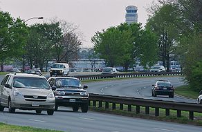
    But there are plenty of examples of freeways with lower speed limits, many of them labeled as "parkways".  In Washington DC, for instance, one finds the George Washington Memorial Parkway and the Clara Barton Parkway--both controlled access, divided highways which look and act like freeways; yet are signed with speed limits ranging from 25-50 MPH (40-80 km/h).  Even the Baltimore/Washington Parkway, a major freeway between DC and Baltimore, is signed at 45MPH for quite a bit of its length.  Yet all three roads are widely used (and widely accepted) by Washington-area commuters.


    Bottom line


    The bottom line for this post is the following:  Freeways perform fine at lower speeds.  The most important attribute of a freeway is not a high speed limit, but controlled access and grade separation--the free flow of traffic.  These attributes make safe travel at high speed possible--highways in urban areas which have high limits but at-grade intersections or unlimited property access tend to acquire reputations as deathtraps--or as ODOT likes to call them, "safety corridors".   However, high speeds are not necessary for a freeway to function as a freeway--and eliminating things like stoplights and driveways will go a lot longer to improving the speed of a highway than simply raising the limit.

    And in the urban context, where the regional mobility function of a highway frequently comes into conflict with the access functions, attempts to simultaneously improve mobility while keeping speeds high, generally are expensive--and interfere greatly with the surrounding community.

    Trading speed (or other performance measures) of for reliability is a common solution in many engineering domains, not just traffic engineering. Yet the tradeoff seems to be something which is regarded as unthinkable by many.

    Which is unfortunate. We could vastly slow down our need to engage in expensive and destructive highway re-designs... if we could simply slow down.

    [edited for typos]